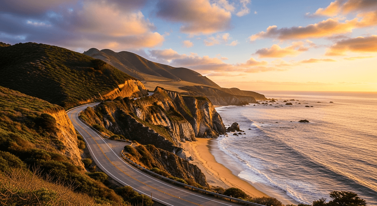

There is a stretch of road in California, running broadly speaking along the edge of the continent, at which the Pacific Ocean arrives with the sort of emphatic grandeur that makes one feel the planet is, on some level, showing off. The waves crash against impossibly dramatic cliffs with the persistence of a metronome that has decided it rather enjoys the sound it makes, while seabirds wheel overhead like critics offering their approval of the whole magnificent production.
The Pacific Coast Highway road trip is not merely a drive from San Francisco to Los Angeles. It is, for those who have experienced it, a recurring event in one's dreams, and occasionally the reason one moves to California entirely. This particular 650 mile journey along Highway 1 transforms the simple act of getting from Point A to Point B into something approaching a religious experience, assuming one's religion involves excellent coastal scenery, improbable engineering, and the sort of driving that requires one to remain alert lest one miss something spectacular around the next bend.
The Route Overview
The Pacific Coast Highway stretches roughly 650 miles from San Francisco's Golden Gate Bridge to the sprawling embrace of Los Angeles, though one could equally well traverse it in reverse if one's philosophical disposition favors different sunset angles. The journey typically requires four to five days for proper appreciation, though three days is possible for those who approach scenic beauty with the efficiency of a business meeting.
The drive time, sans stops, clocks in at approximately 11 hours, but this figure is about as useful as a chocolate teapot, given that stopping is rather the entire point. The route winds through some of the most unreasonably beautiful terrain in North America, including the legendary Big Sur section where the road clings to cliffsides with the determination of a mountain goat in formal wear.
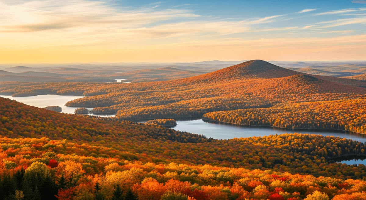
The best season for this adventure runs from late spring through early fall, when the weather maintains that agreeable California disposition and the wildflowers perform their annual show along the coastal bluffs. Winter brings dramatic storms and occasional road closures, while summer delivers crowds that arrive with the enthusiasm of soccer fans at a championship match.
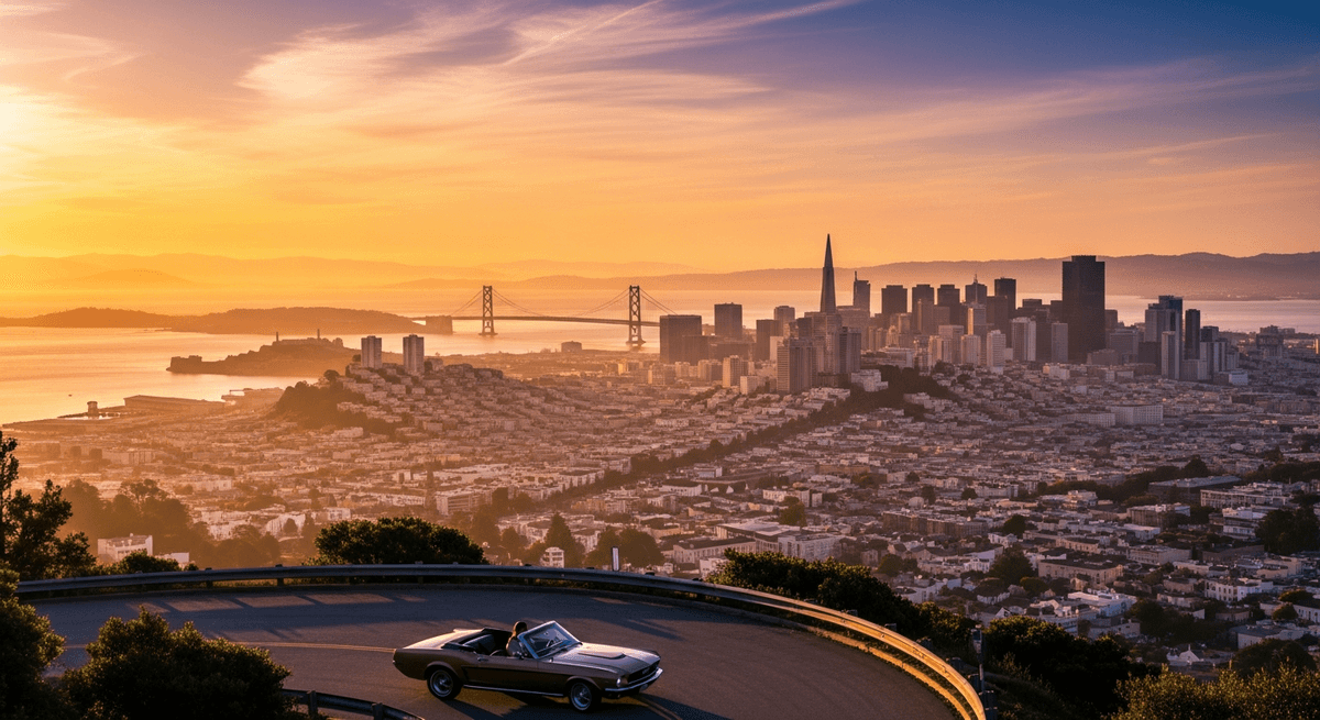
San Francisco: The Magnificent Departure
San Francisco recommends itself as a starting point for several compelling reasons, foremost among which is that departing southward allows one to keep the Pacific Ocean on the passenger side, where it belongs for maximum scenic impact. The city itself, perched on its collection of hills like a Victorian parlor game made architectural, serves as an admirable staging post for the journey ahead.
The departure via the Golden Gate Bridge at dawn, when the fog performs its daily theatrical routine and the bridge emerges from it like something conjured by particularly imaginative Norse gods, costs nothing beyond the petrol and sets the tone for the days ahead with considerable authority. The bridge spans the bay with the confidence of an engineering project that knows it will appear on postcards for the next century.
Before leaving the city proper, one might consider a brief pilgrimage to Fisherman's Wharf for sourdough bread bowls filled with clam chowder, though this requires navigating tourist crowds that move with the coordination of leaves in a windstorm. The Presidio offers a more civilized farewell, with walking trails that provide excellent Golden Gate Bridge photography opportunities without the accompanying circus atmosphere.
Fill the tank here, stock up on provisions, and perhaps invest in a proper road atlas, though GPSSquad handles the route planning with considerably more efficiency than the average human armed with optimism and a smartphone with questionable battery life.
Half Moon Bay: The First Revelation
Half Moon Bay arrives after roughly 30 miles of coastal driving, presenting itself as a community that has decided pumpkins and fishing boats make excellent neighbors. The town sits beside the ocean with the contentment of someone who has found precisely the right spot and sees no reason to overthink the arrangement.
The harbor area bustles with fishing boats that bob in the water like punctuation marks in a nautical sentence, while the local restaurants serve fish tacos that justify the entire concept of coastal cuisine. Sam's Chowder House operates from a building that looks as though it was designed by someone who understood that restaurants beside the ocean should embrace their location rather than apologize for it.
The famous pumpkin patches transform the surrounding fields into an orange carpet each autumn, creating a landscape that appears to have been planned by someone with strong opinions about seasonal aesthetics. Even outside pumpkin season, the agricultural fields roll toward the ocean with the gentle persistence of green waves, providing excellent opportunities for the sort of photographs that make one's friends question their own life choices.
Main Street offers antique shops and bakeries that operate with the unhurried confidence of establishments that know tourists will find them eventually. The weather here maintains that peculiar Northern California habit of being simultaneously sunny and requiring a sweater, so pack accordingly.
Santa Cruz: The Boardwalk Interlude
Santa Cruz appears along the coast like a town that decided the ocean needed a proper amusement park for company and proceeded to build one with Victorian enthusiasm and modern engineering. The famous Boardwalk, complete with roller coaster and Ferris wheel, sits beside the Pacific with the cheerful audacity of a carnival that has decided to make itself permanent.
The Giant Dipper roller coaster, a wooden structure that has been thrilling visitors since 1924, performs its loops and drops with the reliability of a grandfather clock that happens to involve g forces. The ride creaks and groans in ways that wooden roller coasters do, creating an experience that feels simultaneously nostalgic and mildly alarming, like riding through one's childhood memories at considerable speed.
The beach stretches in both directions from the Boardwalk, offering excellent surfing conditions and sand that has achieved that particular California shade of beige that appears in tourism brochures. Local surfers navigate the waves with the casual expertise of people who consider the Pacific Ocean their personal playground, while sea lions occasionally surface to observe the proceedings with the detached interest of maritime critics.
Downtown Santa Cruz operates as a college town should, with coffee shops that take their espresso seriously and bookstores that stock literature alongside surfing magazines. The university campus, perched in the redwoods above town, creates an academic atmosphere that somehow manages to be both scholarly and thoroughly Californian.
Carmel-by the-Sea: The Fairy Tale Village
Carmel-by the-Sea emerges along the coast like a village that escaped from a particularly whimsical fairy tale and decided to establish itself permanently beside the Pacific. The town operates according to its own peculiar logic, where houses look as though they were designed by architects who took their inspiration from enchanted forests, and street names follow no discernible pattern beyond aesthetic appeal.
The main commercial district consists of courtyards and passages that wind between shops selling everything from handcrafted jewelry to wines that cost more than most people's monthly grocery budget. Restaurants occupy buildings that appear to have grown from the ground rather than being constructed by conventional methods, creating dining environments that feel simultaneously rustic and sophisticated.
Carmel Beach stretches below the town like a crescent of sand that has been positioned for maximum scenic effect. The cypress trees that frame the beach bend inland with the permanent lean of dancers frozen mid performance, shaped by decades of Pacific winds into sculptures that no human artist could improve upon.
The former mayor of this establishment was Clint Eastwood, which tells one everything necessary about Carmel's relationship with conventional municipal governance. The town maintains its charm through the simple expedient of refusing to change, operating on the principle that if something works beautifully, one should leave it alone and charge tourists to look at it.
Plan this route with GPSSquad
AI powered itineraries, expense splitting, and group coordination in one app.
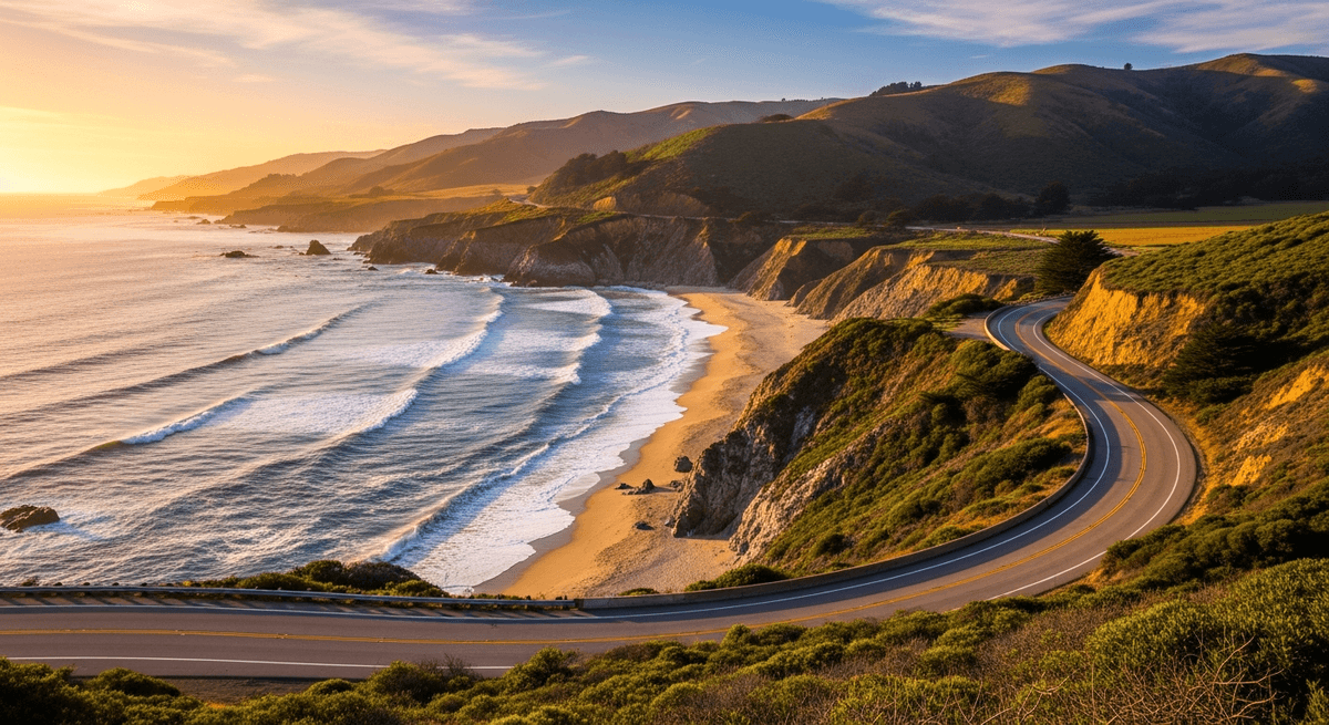
Start Planning FreeBig Sur: Where Geology Gets Theatrical
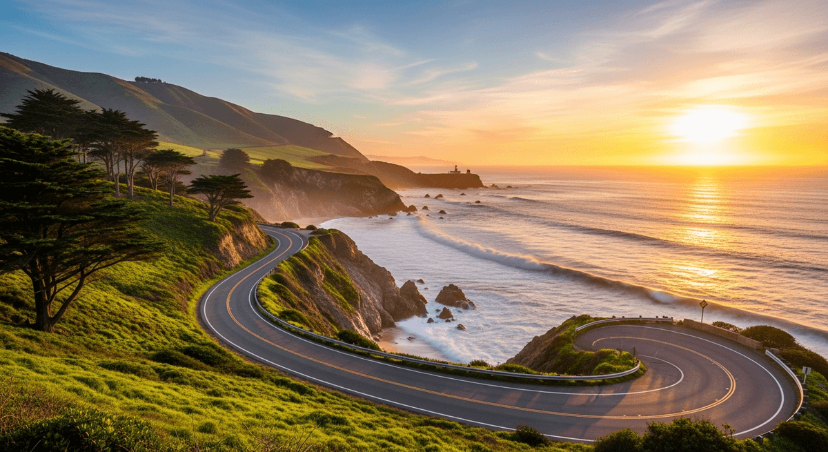
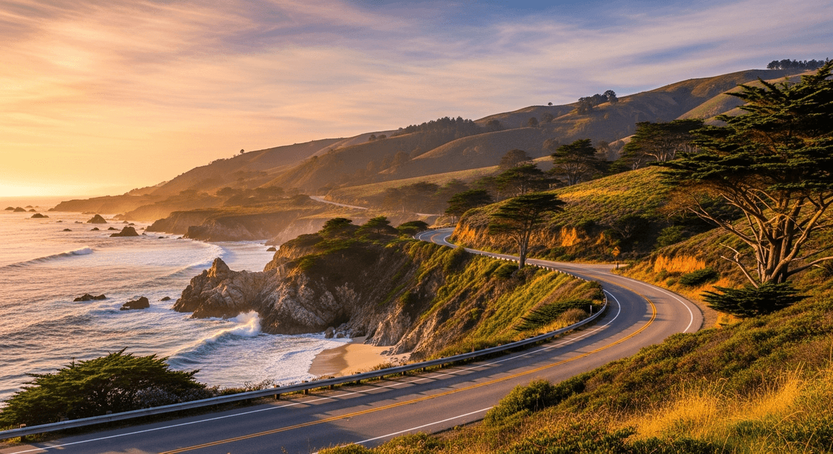
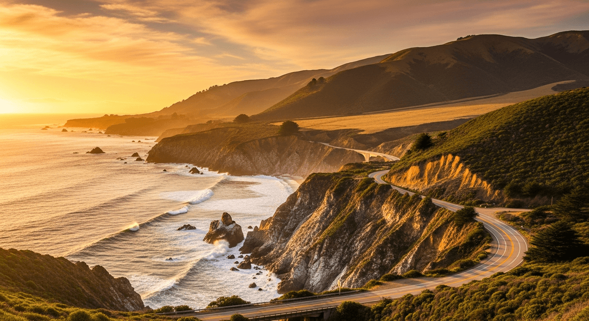
Big Sur begins where the Pacific Coast Highway decides that following the contours of the continent is for roads with insufficient imagination. For the next 90 miles, the highway clings to cliffsides with the determination of a rock climber who has forgotten to bring proper equipment, creating a driving experience that combines spectacular scenery with the sort of engineering that makes one grateful for guard rails.
Bixby Creek Bridge spans its canyon like a concrete rainbow that someone has positioned for maximum dramatic effect. The bridge arches 280 feet above the creek below, offering views that inspire the sort of photography that makes one's social media followers briefly question their own life choices. The surrounding coastline stretches north and south like a demonstration of what happens when the Pacific Ocean decides to take landscape design seriously.
McWay Falls tumbles 80 feet from the clifftop directly onto the beach below, creating a waterfall that appears to have been installed by someone with strong opinions about scenic composition. The falls operate year round with the reliability of a natural feature that knows it photographs well, dropping onto sand that remains perpetually pristine due to its inaccessibility to the general public.
Nepenthe Restaurant perches on a clifftop like a dining establishment that decided the view was more important than convenient parking. The restaurant serves California cuisine while providing panoramic ocean vistas that make every meal feel like a special occasion, even if one has merely ordered a sandwich. The outdoor terrace offers seating arrangements that prioritize scenic appreciation over protection from the elements, operating on the principle that anyone dining this close to the Pacific should expect to share their meal with occasional coastal breezes.
The practical consideration here involves fuel, or rather the notable absence thereof. Big Sur contains precisely zero petrol stations across its 90 mile length, operating on the assumption that drivers will have planned accordingly or will enjoy the character building experience of discovering this fact personally.
San Luis Obispo: The Pleasant Surprise
San Luis Obispo arrives along Highway 101 like a town that remembered it exists to be lived in as well as visited, creating a community atmosphere that feels both welcoming and genuinely functional. The downtown area operates with the efficiency of a place where locals actually conduct their daily business, while simultaneously offering enough charm to satisfy visitors who have developed opinions about authentic California experiences.
The Thursday evening Farmers Market transforms several blocks of Higuera Street into an outdoor festival that happens to also sell excellent strawberries. Local vendors set up booths selling everything from organic vegetables to handcrafted soaps, while musicians perform on street corners with the casual professionalism of people who consider public entertainment a civic duty. The atmosphere buzzes with the energy of a community event that has achieved that rare balance between tourist attraction and genuine local gathering.
The Mission San Luis Obispo de Tolosa, founded in 1772, sits in the town center like a historical anchor that keeps the surrounding development tethered to its origins. The mission operates as both active parish and museum, offering guided tours that explain California's colonial history without requiring visitors to navigate crowds that move like automotive traffic during rush hour.
Cal Poly's campus spreads across the surrounding hills like an educational institution that decided agricultural research and engineering programs deserved particularly attractive settings. The university contributes to the town's atmosphere by ensuring a steady supply of coffee shops that understand espresso and bookstores that stock technical manuals alongside contemporary fiction.
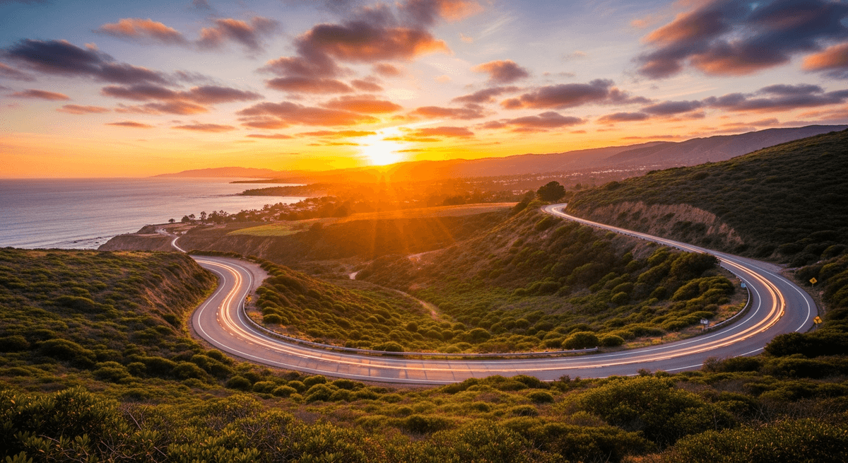
Santa Barbara: The American Riviera
Santa Barbara presents itself along the coast like a city that decided to be uniformly white walled and red tile-roofed and make no apology for the consistency of its aesthetic vision. The Spanish Colonial Revival architecture extends from the waterfront to the foothills with the thoroughness of a community that passed zoning laws and meant them, creating an urban landscape that photographs like a Mediterranean fantasy transplanted to Southern California.
State Street runs from the harbor to the foothills like a main thoroughfare that understands its role as the town's primary stage. Shops and restaurants occupy buildings that maintain the Spanish theme while housing everything from surf shops to galleries selling art that costs more than most automobiles. The outdoor dining areas operate year round thanks to weather that maintains that agreeable Southern California disposition, creating streetscape scenes that appear designed for tourism brochures.
The waterfront area combines working harbor with recreational marina in proportions that suggest careful urban planning. Fishing boats share dock space with pleasure craft, while the beach extends eastward like a public amenity that the city has positioned for maximum accessibility. Palm trees line the coastal drive with the regularity of street lamps, contributing to an atmosphere that feels simultaneously tropical and definitively Californian.
The Santa Barbara County Courthouse operates from a building that looks more like a Spanish palace than a municipal facility, complete with tower that offers panoramic views of the city and surrounding mountains. The architecture suggests that whoever designed municipal buildings in 1929 possessed considerably more imagination than their contemporary counterparts, creating public spaces that inspire rather than merely function.
Practical Planning Considerations
The Pacific Coast Highway road trip requires more advance consideration than the average weekend getaway, operating on the principle that spectacular scenery comes with logistical complications that reward preparation. The route includes sections where cellular service operates sporadically at best, where fuel stations appear with the frequency of shooting stars, and where accommodations book solid months in advance during peak season.
Budget planning should account for California's approach to pricing, which assumes that scenic beauty justifies premium charges for everything from gasoline to sandwiches. Expect to pay resort prices for roadside motels, especially in Big Sur, where lodging costs reflect the simple economic reality that spectacular locations can charge accordingly. Camping offers more affordable alternatives, though reservations for state park campgrounds require the sort of advance planning typically associated with space missions.
Vehicle preparation matters more than one might initially assume. The mountainous sections demand reliable brakes, while the coastal portions involve salt air that regards automotive finishes as personal challenges to overcome. Pack emergency supplies including extra water, snacks that won't perish in warm weather, and layers of clothing that account for California's inability to maintain consistent temperatures across geographical or temporal boundaries.
The ideal timing balances weather conditions against crowd levels, aiming for late spring or early fall when the wildflowers perform their seasonal display and the summer tourist migration has yet to reach full intensity. Winter brings dramatic storm systems that create excellent photography opportunities while occasionally closing sections of the highway, requiring the sort of flexibility that some travelers find invigorating and others find insufferable.
GPSSquad handles the route optimization, fuel stop coordination, and accommodation booking with considerably more efficiency than the average human armed with good intentions and a smartphone. For those who appreciate America's legendary highways, the Route 66 road trip offers a different but equally compelling journey across the continent, while the Blue Ridge Parkway scenic drive showcases the eastern United States' most spectacular mountain vistas. The alternative involves spending vacation time researching logistics rather than appreciating scenery, which rather defeats the purpose of taking a scenic route in the first place. For drivers seeking dramatic coastal landscapes beyond California, the Florida Keys road trip provides an entirely different oceanic perspective, while the Glacier National Park road trip delivers mountain scenery that rivals the Sierra Nevada. Plan this trip on GPSSquad.