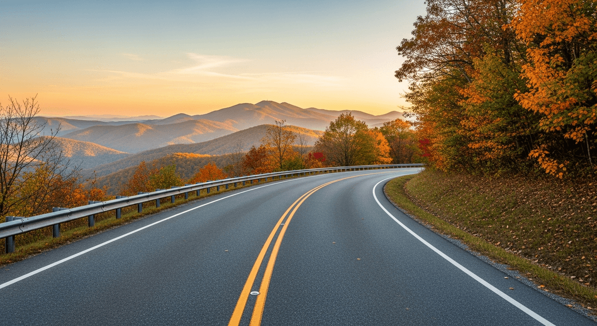

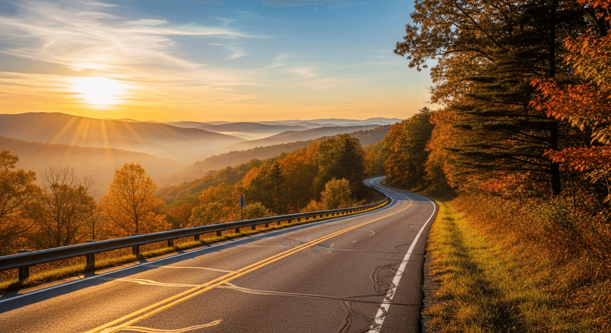
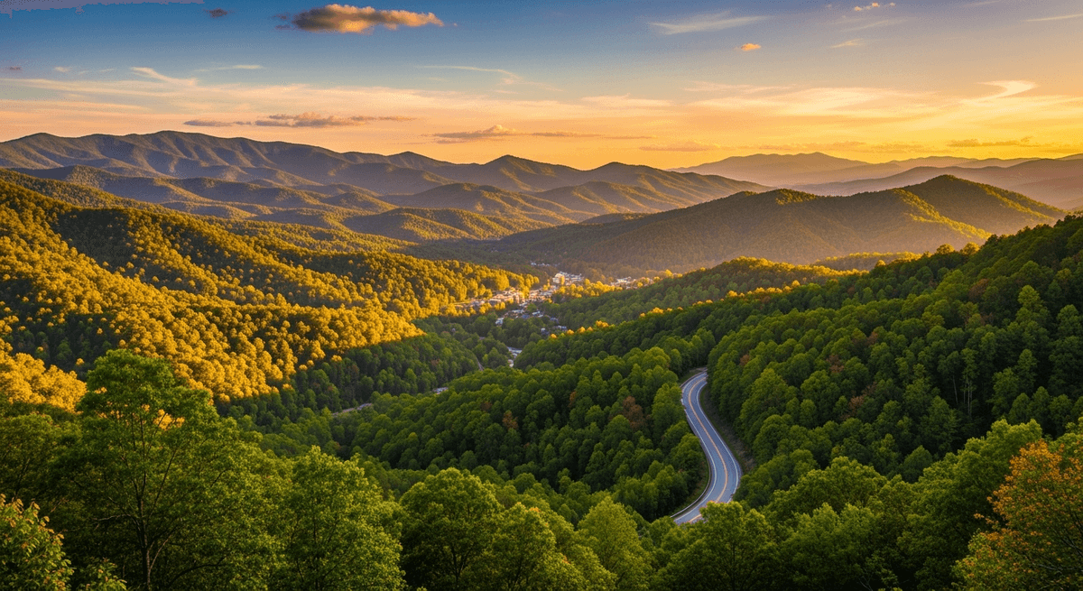
There are roads one drives for the practical business of getting from here to there, and there are roads one experiences like a leisurely conversation with a particularly eloquent landscape. The Blue Ridge Parkway scenic drive falls emphatically into the second category, a 469 mile ridgeline journey through the Appalachian Mountains that meanders from Shenandoah National Park in Virginia to Great Smoky Mountains National Park in North Carolina with the unhurried confidence of someone who knows they have the best stories to tell.
This remarkable ribbon of asphalt was conceived during the Great Depression by minds that understood the therapeutic value of beauty, and completed with the sort of attention to detail that makes every curve, every overlook, and every stone guardrail feel like it was positioned by someone with strong aesthetic opinions and unlimited patience. The result is a road trip that unfolds like a particularly well edited documentary about the art of being magnificent, where each mile marker introduces another chapter in what amounts to a 469 mile treatise on why the eastern United States keeps its best secrets tucked away in the mountains.
The Route: A Ridgeline Romance
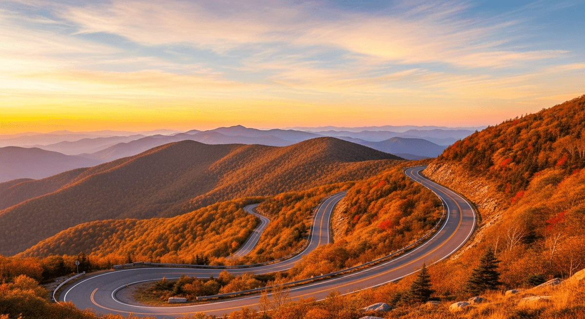
The Blue Ridge Parkway scenic drive stretches 469 miles along the spine of the Appalachian Mountains, connecting two of America's most celebrated national parks via a route that maintains an elevation between 1,000 and 6,000 feet with the steady determination of a mountain goat with excellent taste in real estate. The drive typically requires five to seven days if one intends to experience rather than merely complete it, though the route can be rushed in two days by drivers possessed of more schedule than sense.
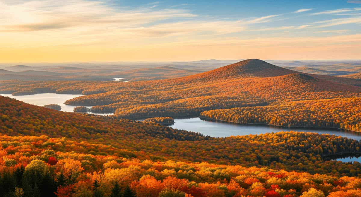
The optimal season depends entirely on one's priorities: late May brings wildflowers that carpet the mountainsides like nature's own Persian rugs, while mid October delivers autumn colors that photographers attempt to capture and poets struggle to describe adequately. Summer offers the longest days and warmest weather, though also the heaviest traffic. Winter brings solitude and crystalline views, along with the possibility of snow closures that can transform a scenic drive into an unexpected lesson in patience.
The speed limit holds steady at 45 mph throughout, which initially strikes hurried drivers as restrictive until they realize it represents not a legal requirement but a philosophical statement about the proper pace for absorbing scenery of this caliber.
Shenandoah's Gateway: Where the Journey Begins
The adventure commences at Rockfish Gap near Waynesboro, Virginia, where the Blue Ridge Parkway accepts the baton from Skyline Drive like a relay runner confident in their ability to maintain the standard. The first few miles establish the tone with overlooks that offer views across the Shenandoah Valley, a pastoral expanse that rolls toward the horizon like green velvet draped across the furniture of geology.
Humpback Rocks at Milepost 5.8 presents the first opportunity to stretch legs that will grow accustomed to frequent stops. The mile long hike to the summit rewards visitors with 360 degree views and a collection of reconstructed farm buildings that demonstrate how previous generations managed to scratch out livings from landscapes that modern visitors consider purely decorative. The visitor center offers exhibits on mountain life that provide context without resorting to excessive sentimentality about the good old days, which generally weren't.
For provisions, the nearby town of Waynesboro offers the last reliable fuel and supplies for the next 30 miles, making it advisable to approach the station with the thoroughness of an Antarctic expedition organizer. The local restaurants serve the sort of hearty fare that mountainous terrain seems to inspire: substantial breakfasts that acknowledge the day's scenic challenges ahead.
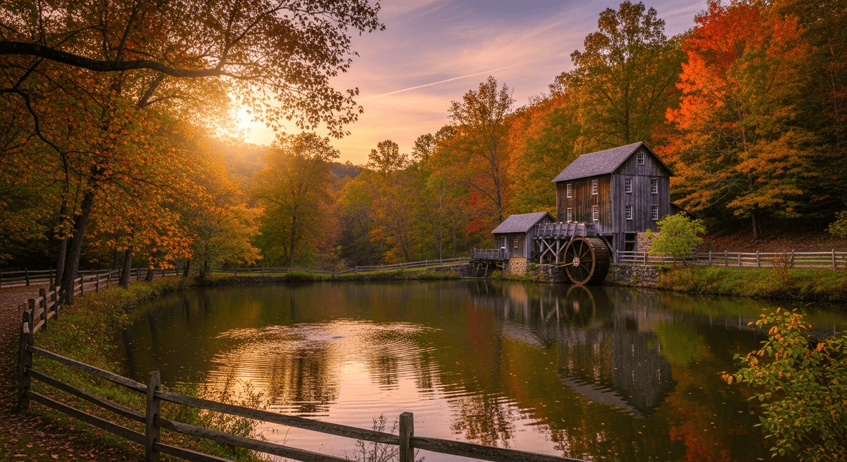
Mabry Mill: Where Time Moves at Millstone Speed
At Milepost 176.1, Mabry Mill stands as the most photographed structure along the entire Blue Ridge Parkway, a distinction it wears with the modest dignity of an institution that has been grinding corn and producing molasses since 1910. The mill operates with the quiet confidence of machinery that predates the concept of planned obsolescence, powered by a waterwheel that turns with the measured rhythm of someone who has seen trends come and go and expects to outlast the current ones as well.
During autumn, the mill pond reflects the surrounding maples and dogwoods like a mirror held up to nature's most ambitious art project. The adjacent trails wind through forests where the understory blazes with colors that seem to have been mixed by someone with access to a particularly well stocked palette and no concern for subtlety. Photography enthusiasts arrive before dawn to capture the mill in the golden light that makes even practical structures appear touched by magic.
The mill's restaurant serves buckwheat pancakes made from flour ground on the premises, a detail that transforms breakfast from mere sustenance into a form of historical participation. The gift shop offers local crafts and maple syrup that provide excellent excuses for extending the visit beyond what strict scheduling might recommend.
Grandfather Mountain: Where Heights Meet Heights
Grandfather Mountain at Milepost 305 rises to 5,946 feet with the imposing presence of a geological celebrity accustomed to admiration. The mountain's famous Mile High Swinging Bridge spans 228 feet between two peaks, offering views that extend to the theoretical edge of Virginia on clear days and providing a gentle swaying motion that adds adventure to sightseeing in ways that ground level overlooks simply cannot match.
The approach road climbs through forests that shift from hardwoods to spruce fir as elevation increases, creating distinct ecological zones that botanists find fascinating and casual visitors find pleasantly mysterious. Wildlife viewing opportunities include black bears, who maintain the mountains with the proprietorial air of longtime residents, and peregrine falcons, who patrol the heights like aerial security guards with excellent eyesight and strong opinions about territorial boundaries.
The Nature Museum provides context about the mountain's unique ecosystem without overwhelming visitors with more scientific detail than a scenic road trip can reasonably accommodate. The hiking trails range from gentle walks suitable for contemplative strolling to challenging climbs that reward effort with views that justify the investment of time and cardiovascular energy.
Plan this route with GPSSquad
AI powered itineraries, expense splitting, and group coordination in one app.
Start Planning FreeAsheville: Where Mountains Meet Civilization
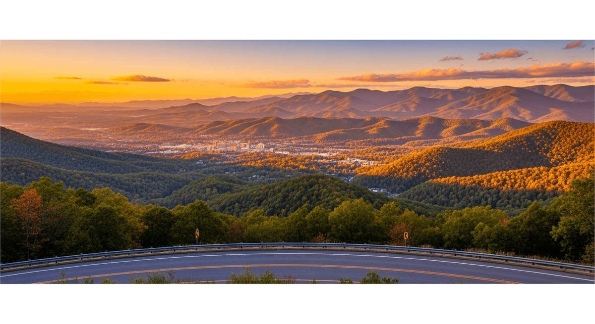
The Blue Ridge Parkway curves around Asheville, North Carolina, like a scenic embrace of a city that understands its role as the cultural capital of the Southern Appalachians. This artistic community nestled in a bowl of mountains offers the sort of sophisticated amenities that make excellent base camps for multi day Parkway explorations: craft breweries that take their mountain water seriously, restaurants that treat local ingredients with appropriate reverence, and accommodations that range from historic inns to modern hotels with views that guests find difficult to leave.
The Biltmore Estate, while technically off the Parkway, merits consideration as the sort of architectural extravagance that the Gilded Age produced when industrialists decided that summer homes should be constructed on the scale of small European principalities. The house contains 250 rooms arranged with the casual excess of someone who considered restraint a character flaw, surrounded by gardens that demonstrate what unlimited budgets can accomplish when applied to horticulture.
Downtown Asheville's arts district provides galleries, music venues, and shopping opportunities that serve as pleasant interludes between mountain experiences. The local breweries produce ales and lagers that pair excellently with mountain scenery and the sort of philosophical discussions that high altitude seems to encourage. The farmers market showcases regional specialties including apple butter, honey, and handcrafted items that make excellent souvenirs or gifts for those unfortunate enough to be experiencing this journey vicariously.
Cherokee and the Smokies: Where the Journey Culminates
The Blue Ridge Parkway concludes at Cherokee, North Carolina, gateway to Great Smoky Mountains National Park, where the road hands off responsibility for continued scenic amazement to peaks that rise like blue hazed pyramids toward a sky that seems higher and more expansive than physics should reasonably allow. The Cherokee Indian Reservation provides cultural context and educational opportunities that enrich understanding of the region's human history beyond the purely geological narrative.
The transition from Parkway to Smokies feels like turning the page from one magnificent chapter to another in a book about why eastern mountains deserve more attention than they typically receive. The famous blue haze that gives the mountains their name results from isoprene emitted by the dense vegetation, a scientific explanation that does nothing to diminish the mystical quality of peaks that seem to dissolve into sky like watercolor paintings left in the rain.
Great Smoky Mountains National Park offers hiking opportunities that range from gentle nature walks to challenging backcountry expeditions, along with historic buildings, waterfalls, and wildlife viewing that can easily extend a Blue Ridge Parkway road trip by several days. The park's entrance at Cherokee provides visitor centers, accommodations, and dining options that serve as excellent staging areas for continued mountain adventures.
Planning Your Blue Ridge Parkway Adventure
The optimal timing for a Blue Ridge Parkway scenic drive depends largely on one's tolerance for crowds versus desire for specific seasonal displays. Autumn brings the famous foliage that attracts visitors like moths to particularly colorful flames, with peak colors typically occurring from mid October in Virginia to early November in the southern reaches of North Carolina. Spring offers wildflowers, dogwood blossoms, and fewer fellow travelers, though weather can be unpredictable with the capricious nature of mountain seasons.
For those planning multiple scenic drives in different regions, autumn also provides excellent opportunities to explore New England Fall Foliage in September and early October before heading south to catch the Blue Ridge colors at their peak. Budget considerations should account for the fact that the Parkway itself charges no admission fees, making it one of America's great bargains in scenic entertainment. Fuel stops require planning since gas stations exist only in towns accessible via side roads, not on the Parkway itself. This design feature ensures scenic integrity while occasionally providing excitement for drivers who interpret fuel gauges optimistically. Accommodations range from camping in national forests to luxury resorts in gateway communities, with prices reflecting proximity to peak season and popular destinations.
Essential packing includes layers for temperature variations that can span 30 degrees between valley and ridge, comfortable walking shoes for overlook exploration, and camera equipment capable of handling lighting conditions that range from deep forest shade to brilliant mountain sunshine. Weather can change with the speed of mountain moods, making rain gear advisable regardless of forecasts. Snacks and water prove essential for a drive where the next supply stop might be 50 miles and several overlooks away.
The Blue Ridge Parkway scenic drive rewards careful planning while remaining forgiving enough to accommodate spontaneous discovery. Consider combining it with other iconic American drives like Route 66 for a cross-country adventure, or pair it with Glacier National Park for a coast to coast exploration of America's most scenic mountain roads. GPSSquad's intelligent route planning coordinates timing with elevation changes, matches autumn color predictions to specific mileposts, and ensures fuel stops align with your vehicle's range. Rather than spending evenings puzzling over milepost charts and elevation profiles, you can focus on the more enjoyable questions: which overlook deserves the sunrise visit, and whether that meadow full of wildflowers merits an unscheduled picnic stop. Plan this trip on GPSSquad.