

There exists a road trip that sorts travelers into two distinct categories with the ruthless efficiency of a particularly discerning headmaster: those who have driven from Manali to Leh, and those who have not yet discovered what their vehicle and their constitution are actually made of. This 490 kilometre journey through the Himalayas operates like a gentleman's club with rather extreme membership requirements, demanding proof of both mechanical reliability and personal fortitude before admitting one to the rarefied atmosphere of Ladakh.
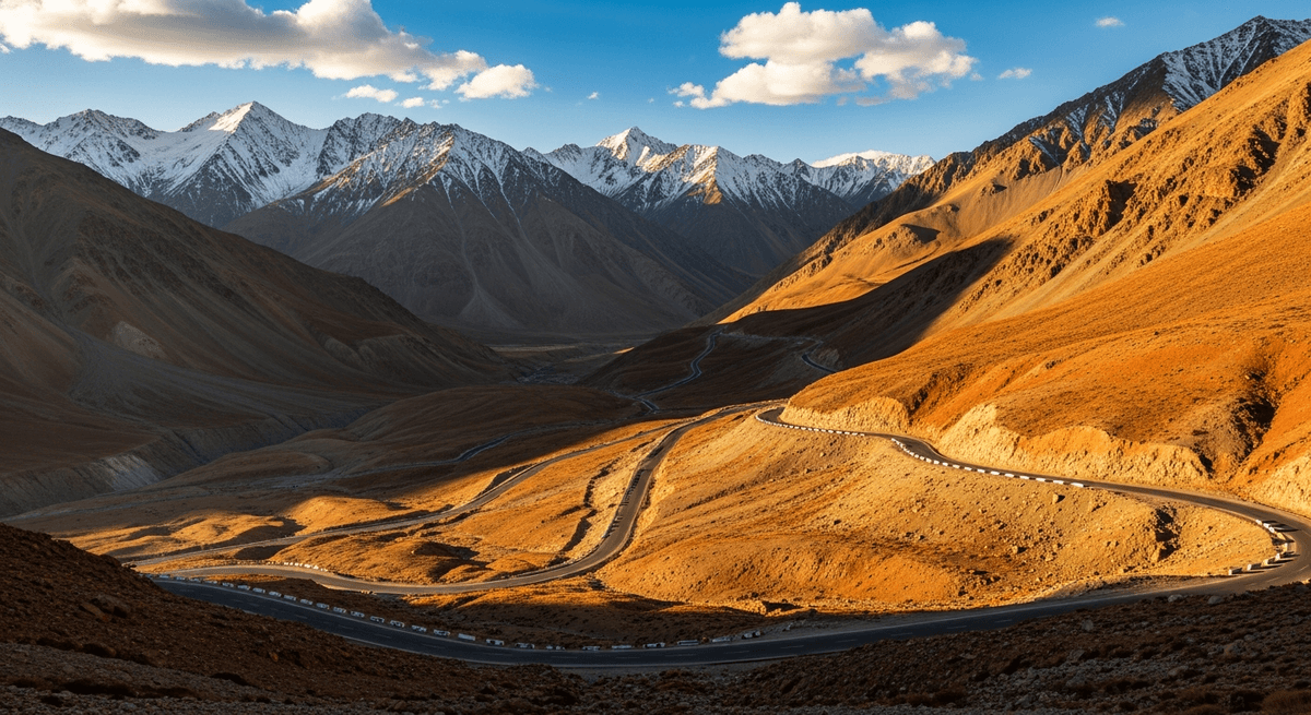
The Manali to Leh highway, officially designated NH3, threads through five high altitude mountain passes with the determined precision of a mountaineer's route, climbing through the Rohtang Pass, Baralacha La, Nakeela Pass, Lachulung La, and finally the Tanglang La at 5,328 metres, which advertises itself as the world's second highest motorable road with the proprietary pride of a peak that has earned its superlatives at considerable expense to both oxygen levels and engine performance. This is not a road trip that accommodates the unprepared with the indulgent patience of a Sunday drive through the Cotswolds.
Route Overview: The Himalayan Highway's Essential Details
The complete journey covers 490 kilometres over two to three days, depending on one's approach to altitude acclimatization and scenic appreciation. The road operates under seasonal restrictions with the absolute authority of the Himalayan climate, opening only between late June and October, when the snow clears sufficiently to reveal what might generously be termed a motorable surface. Outside these months, the route exists purely as a geographical concept, buried under snow drifts that treat human transportation schedules with the dismissive indifference they deserve.
Drive time ranges from 12 to 18 hours of actual driving, spread across multiple days to accommodate altitude adjustment, meal breaks, photography stops, and the occasional mechanical consultation that high altitude driving tends to inspire. The journey begins at Manali's civilized altitude of 2,050 metres and concludes in Leh at 3,500 metres, having crossed passes that exceed 5,000 metres with the casual inevitability of a conversation that gradually becomes more philosophical as the evening progresses.
The optimal season runs from July through September, when road conditions achieve their annual peak of what might charitably be described as adequate, and weather patterns demonstrate their least vindictive behavior. Early October offers crisp clarity but carries the risk of sudden closures, while late June involves navigating sections that remain more optimistic than operational.
Manali: The Civilized Farewell to Creature Comforts
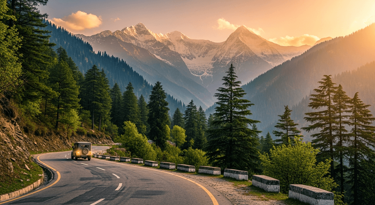
Manali serves as the expedition's launching point, a hill station that combines Himalayan grandeur with the reassuring presence of proper hotels, restaurants that understand the concept of multiple courses, and shops that stock items one might actually need rather than merely want. The town sits in the Kullu Valley like a comfortable armchair positioned strategically before a magnificent view, offering two essential days of acclimatization that transform from a medical recommendation into a pleasant necessity.
The Hadimba Temple, constructed in 1553, provides a wooden architectural marvel that demonstrates what happens when craftsmen decide to build something worthy of the deodar forests that surround it. The structure combines Pahari architectural traditions with decorative elements that would impress a peacock, all situated within a cedar grove that maintains the hushed atmosphere of a natural cathedral. The nearby Manu Temple marks the mythological beginning of human civilization according to Hindu tradition, though visitors might reasonably question whether beginning civilization at 2,050 metres was entirely practical planning.
Local dining reaches its apotheosis at Johnson's Cafe, where continental cuisine meets Himachali hospitality in combinations that shouldn't work but persistently do, much like the entire concept of roads through the Himalayas. The trout preparations deserve particular attention, sourced from local streams that maintain temperatures suitable for fish that clearly appreciate good living conditions. Old Manali's cafes offer Tibetan momos and thukpa that serve as practical training for the Ladakhi cuisine awaiting at journey's end, though served in considerably more comfortable circumstances.
Rohtang Pass: Where the Real Adventure Announces Itself
Rohtang Pass, at 3,978 metres, marks the point where the journey transforms from scenic drive to genuine expedition, shedding its tourist friendly demeanor like a butler removing his formal jacket before engaging in serious manual labor. The name derives from the Tibetan "Rotang," meaning "pile of corpses," which represents the kind of geographical nomenclature that establishes expectations with admirable clarity. Early morning departure before 6am becomes essential, not merely to avoid crowds but to secure passage before afternoon weather patterns begin their daily demonstration of meteorological authority.
Beyond the pass, the landscape undergoes a transformation as dramatic as a stage set change, abandoning the Kullu Valley's green abundance for the stark, magnificent desolation of the high Himalayas. The shift occurs with the abruptness of stepping from a well appointed drawing room into the vastness of space itself, leaving behind everything familiar and proceeding into terrain that operates according to entirely different rules of hospitality and survival.
The Rohtang Tunnel, opened in 2020, provides an alternative route that bypasses the pass entirely, offering year round access to Lahaul Valley with the reliability of modern engineering. However, choosing the tunnel over the pass resembles reading the synopsis instead of the novel: technically adequate but missing the point entirely. The pass route delivers the full Himalayan experience, complete with altitude effects, weather uncertainty, and views that justify every moment of automotive anxiety.
Fuel availability beyond Rohtang becomes sporadic with the unpredictability of mountain weather, making the carry of additional 20 litres not a precaution but a requirement. The landscape's beauty increases in direct proportion to its inhospitability, reaching levels that inspire both awe and acute awareness of one's mechanical dependencies.
Keylong and Jispa: Civilization's Last Comfortable Outposts
Keylong, the district headquarters of Lahaul and Spiti, emerges from the Bhaga Valley like a reassuring message from civilization, confirming that human settlement remains theoretically possible even at 3,350 metres altitude. The town operates as the route's final opportunity to experience conventional amenities, including hotels with actual walls rather than canvas, restaurants with menus that extend beyond instant noodles, and shops that stock items more sophisticated than emergency chocolate.
The Kardang Monastery, perched on a hillside across the Bhaga River, provides spiritual and architectural relief from the journey's increasingly austere landscape. Founded in the 12th century, the monastery houses ancient murals and statues that demonstrate how artistic achievement flourishes even in conditions that would challenge a mountain goat's residential preferences. The monastery's location offers panoramic views of the Lahaul Valley that justify the steep climb required to reach it, though visitors should note that "steep" at this altitude carries implications beyond the merely topographical.
Jispa, eight kilometers beyond Keylong, provides a quieter alternative overnight stop, situated along the Bhaga River with the kind of pristine mountain setting that travel brochures attempt to capture but consistently underestimate. The village's guesthouses offer basic but adequate accommodation, where the absence of luxury amenities becomes compensated by the presence of absolute silence and air so clear it seems to have been filtered through diamond dust.
Local dining focuses on practical sustenance rather than culinary adventure, though the dal chawal combinations achieve a comforting reliability that grows increasingly precious as one progresses toward more remote regions. The area's trout fishing provides both sport and protein, though the fish inhabiting these high altitude streams possess the kind of wariness that suggests they've developed philosophical reservations about terrestrial visitors.
Plan this route with GPSSquad
AI powered itineraries, expense splitting, and group coordination in one app.
Start Planning FreeBaralacha La and Sarchu: Into the High Wilderness
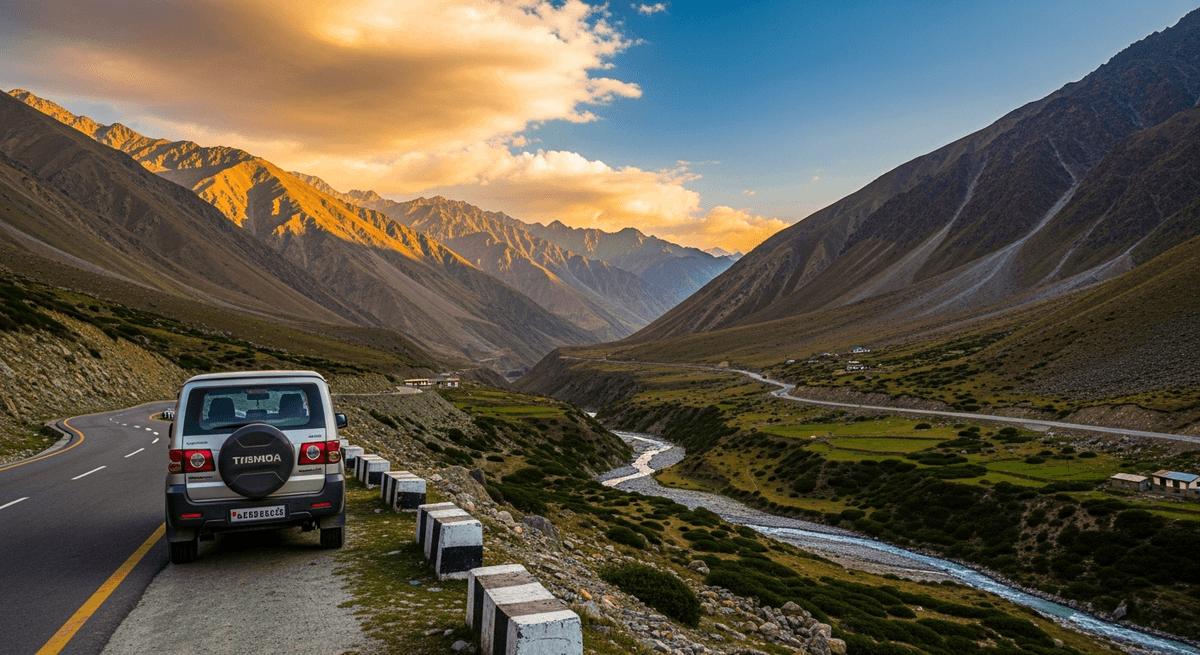
Baralacha La, at 4,890 metres, represents the route's entry into truly high altitude terrain, where the air becomes so thin it seems to have been diluted with altitude itself. The pass marks the watershed between the Chenab and Indus river systems, a geographical distinction that carries all the practical implications of standing at the continental divide while experiencing the effects of oxygen deprivation that makes philosophical contemplation both irresistible and slightly unreliable.
Sarchu campsite, at 4,290 metres, provides the route's traditional overnight stop, a collection of tented accommodations arranged across a high altitude plain with all the comfort and protection that canvas can reasonably provide against Himalayan weather conditions. The site operates like a frontier settlement where travelers gather to share stories of mechanical difficulties overcome and altitude symptoms endured, creating a temporary community bound by the shared experience of choosing to drive through terrain that sensible people approach only in well equipped aircraft.
The overnight temperatures at Sarchu drop with the enthusiasm of a barometer in a typhoon, often reaching near freezing levels even in summer months. The sky, however, compensates with a clarity that urban dwellers find almost overwhelming, displaying stars with the brilliant intensity of diamonds scattered across black velvet by someone with exceptionally good taste and unlimited resources. The Milky Way appears not as a faint suggestion but as a prominent celestial feature, providing the kind of astronomical display that reminds one why ancient civilizations developed mythology to explain phenomena that exceeded their conceptual frameworks.
Dining at Sarchu consists primarily of basic but warming meals prepared in camp kitchens that operate under conditions that would challenge a professional chef's ingenuity. The dal and rice combinations achieve new levels of appreciation when consumed at altitude after a day of high mountain driving, though one's standards for culinary excellence do undergo certain practical adjustments under these circumstances.
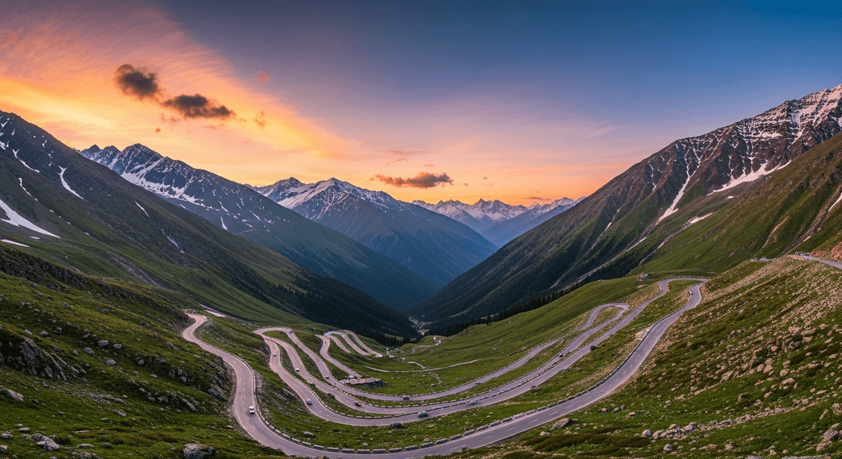
Pang and the Morey Plains: The Himalayan Moonscape
Pang, situated at 4,600 metres on the edge of the Morey Plains, provides accommodations that redefine the concept of basic amenities, offering shelter that operates according to the principle that any protection from the elements constitutes luxury when surrounded by landscape that resembles an alien planet designed by someone with a preference for stark minimalism. The settlement consists of a few structures that cling to existence with the determination of high altitude vegetation, providing meals and rest stops that become precious precisely because of their improbability in such surroundings.
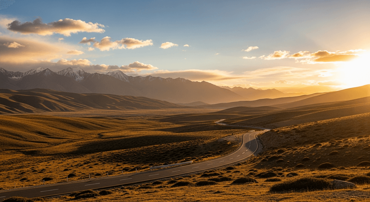
The Morey Plains stretch beyond Pang like an enormous outdoor cathedral constructed from earth and sky, a high altitude plateau where the road runs straight as an arrow across terrain so vast and empty that distance becomes a purely theoretical concept. The landscape operates according to its own rules of perspective, where mountains that appear nearby prove to be hours of driving distant, and the horizon seems to recede with each mile traveled, like a philosophical argument that grows more complex the closer one examines it.
This section of the route challenges vehicles and drivers with equal intensity, combining altitude effects with road surfaces that vary from adequate to optimistic, depending on recent weather and the maintenance schedule of equipment that operates under conditions that would qualify as extreme testing for automotive manufacturers. The terrain's beauty increases in direct proportion to its inhospitability, reaching levels that inspire both reverence and acute awareness of one's dependence on mechanical reliability and favorable weather conditions.
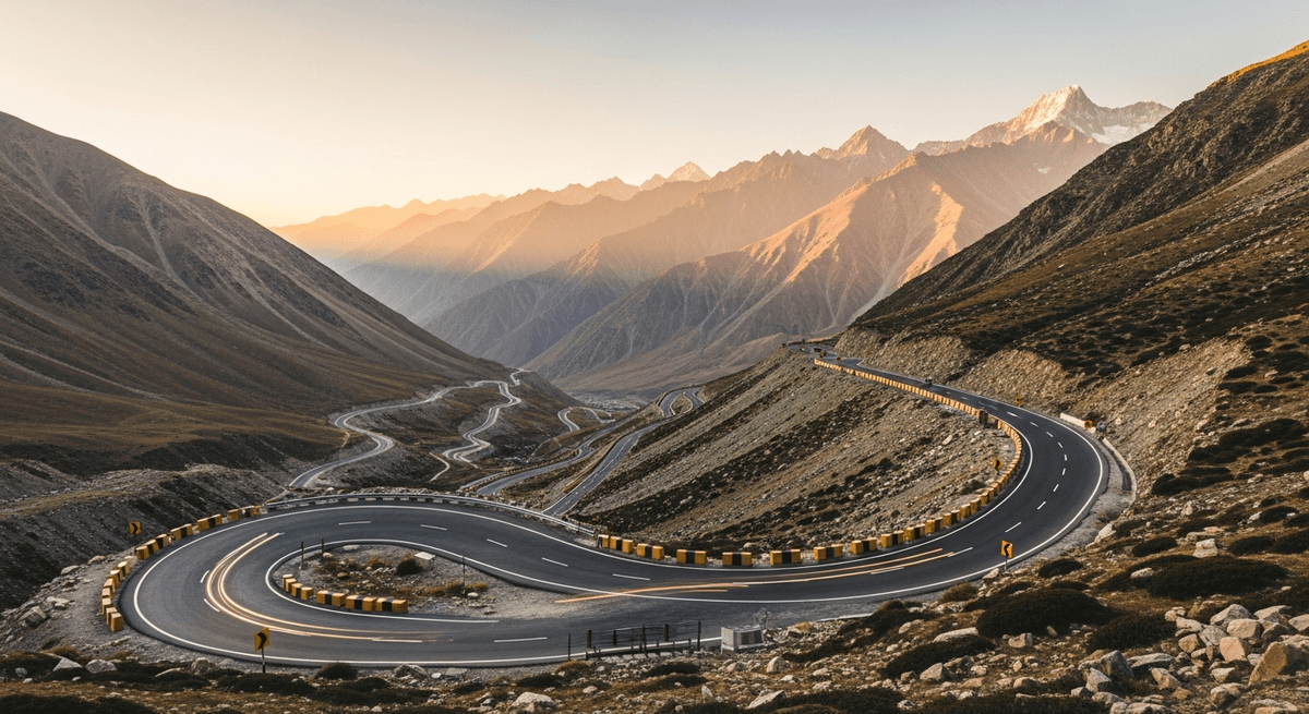
Tanglang La: The Journey's Highest Achievement
Tanglang La, at 5,328 metres, represents the route's culminating challenge and ultimate achievement, a mountain pass that advertises itself as the world's second highest motorable road with the justified pride of a peak that has earned its superlatives through sheer altitude and the courage of the road engineers who decided such a project represented a reasonable use of human ingenuity. The ascent to Tanglang La tests both vehicle performance and human physiology with the thoroughness of a comprehensive examination administered at altitude where even thinking requires additional effort.
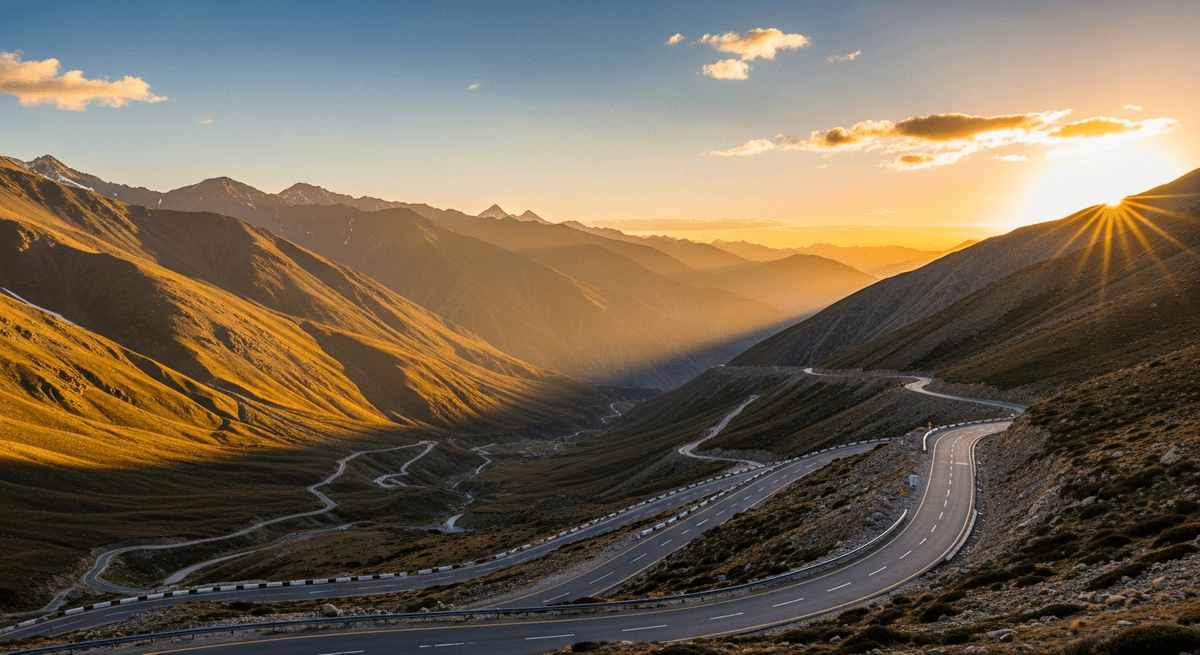
The views from the pass justify every moment of automotive anxiety and altitude adjustment experienced during the preceding days, offering panoramic vistas that encompass mountain ranges extending to horizons that seem to curve with the earth's surface. The landscape spreads below like a three dimensional map constructed by someone with unlimited resources and a preference for dramatic topography, demonstrating why the Himalayas have inspired both spiritual reverence and geographical superlatives throughout human history.
The descent from Tanglang La toward Leh provides psychological relief as significant as the physical benefits of returning to slightly more reasonable altitudes, though "reasonable" in this context remains relative to conditions that would challenge a Sherpa's definition of routine travel. The road winds through increasingly hospitable terrain, where the appearance of vegetation and signs of permanent human settlement become as welcome as familiar faces at a reunion.
Practical Planning: Essential Preparations for High Altitude Success
Successful completion of the Manali to Leh route requires preparation that extends beyond the conventional road trip checklist, demanding attention to medical, mechanical, and meteorological factors that rarely concern drivers operating at sea level. Altitude medication, specifically Diamox (acetazolamide), should be obtained through medical consultation before departure, as altitude sickness affects individuals with the democratic indifference of a condition that recognizes no distinction between physical fitness and wishful thinking.
Vehicle selection becomes crucial beyond the typical considerations of comfort and fuel economy, requiring capabilities that can handle unpaved sections, steep gradients, and thin air that reduces engine performance with measurable efficiency. Four wheel drive vehicles, particularly SUVs and the iconic Royal Enfield motorcycles favored by experienced travelers, represent appropriate choices for terrain that treats automotive optimism with the skepticism it deserves.
The Inner Line Permit for Ladakh requires advance application through the Ministry of Home Affairs' online portal, a bureaucratic necessity that becomes significantly more complicated when attempted from remote locations with unreliable internet connectivity. Weather monitoring becomes essential, as mountain conditions change with the rapidity of a temperamental artist's mood, potentially closing passes with little advance warning.
Packing requirements extend beyond normal travel needs to include warm clothing suitable for sub freezing temperatures, medical supplies for altitude related symptoms, emergency food supplies, extra fuel capacity, and basic tools for minor mechanical adjustments that high altitude driving tends to require. Cash reserves become essential, as electronic payment systems operate with the reliability of mountain weather patterns in regions where electricity itself represents an achievement worth celebrating.
The Manali to Leh road trip rewards careful preparation with experiences that exceed most travelers' capacity for superlatives, delivering landscapes and challenges that remain memorable long after the altitude symptoms fade and the vehicle returns to sea level performance standards. For travelers seeking other epic journeys through India's diverse landscapes, a Kerala road trip offers a striking contrast with its lush backwaters and tropical abundance, while the neighboring Spiti Valley provides equally dramatic high altitude terrain with its own unique character. Those considering India's southwestern coast might explore a Mumbai to Goa journey for an entirely different driving experience through coastal landscapes. Plan this trip on GPSSquad.